-40%
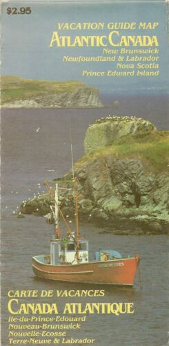
1979 Road Map ATLANTIC CANADA New Brunswick Nova Scotia Prince Edward Island NL
$ 4.21
- Description
- Size Guide
Description
1979 Road Map ATLANTIC CANADA New Brunswick Nova Scotia Prince Edward Island NLHandsome fold-out vacation guide road map of Atlantic Canada, printed more than 34 years ago.
This map opens to a generous 68.5 x 98 cm [27" x 38-1/2"], and the coverage area includes New Brunswick, Newfoundland & Labrador, Nova Scotia and Prince Edward Island. The scan below shows the rear cover:
This map published in 1979 by the Maritime Resource Management Service, Amherst, Nova Scotia. It is dated by the status of the work in progress on the Cape Spear lighthouse restoration.
Condition:
It is in
excellent condition,
bright and clean, with
no
marks, rips, or tears. We are pleased to offer it with
our unconditional, money-back guarantee.
Powered by SixBit's eCommerce Solution


